60 Years Ago First Satellite Image of Earth
On August 7, 1959, the Explorer 6 satellite launched atop a Thor-Able rocket from Cape Canaveral, Florida. Its mission was to study Earth’s electrical and magnetic fields in the upper atmosphere, but it also carried a device for scanning and photographing cloud cover.
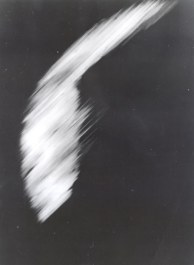
Approximately a week into the mission, it captured and transmitted the first photograph of Earth via satellite while orbiting over Mexico. The image was unpolished, showing the north central Pacific Ocean. It took about 40 minutes to transmit it to a Hawaii ground station.
Explorer 6 was the first scientific satellite under the direction of NASA’s Goddard Space Flight Center in Maryland, which went on to operate tracking and communications networks for the crewed missions of the Mercury, Gemini and Apollo programs. The satellite was spheroidal, meaning it’s shape was circular, and it entered a highly elliptical orbit around Earth after launch.
Early missions like Explorer 6 pushed the boundaries of what was defined as possible. Only 10 years later, history was made when humans took the first steps on the Moon. On this journey, we have also learned more about Earth. Explorer 6 gave us one of the first views at the small, blue planet we know as home. During your visit, be sure to walk through the Rocket Garden and stop in to our Heroes and Legends attraction, which honors the early space program and those first steps into the unknown.